
Understanding Urban Density
How a bespoke densification model can unlock London’s future growth.
Authors: George Garofalakis, Alexander Alexiou and Daphne Delfaki
Year: 2020
Our understanding of urban density is rapidly changing. Fuelled by urbanisation, population growth, technology proliferation, changing lifestyles and behaviours and challenged by climate and health crises, cities are seeking new models for future growth. In this future, resilience-driven urban landscape, density has a key role to play. Treated not as an enabler of monolithic high-rises but as a tool for bespoke, balanced and safe placemaking, urban density has the potential to future-proof neighbourhoods, districts and cities.
There is a great difference between physical density and perceived density. In other words, it is not the density itself that is sought after, but rather the quality that the dense urban environment produces, in the form of proximity to work, cultural offerings, activities, parks, and so on.

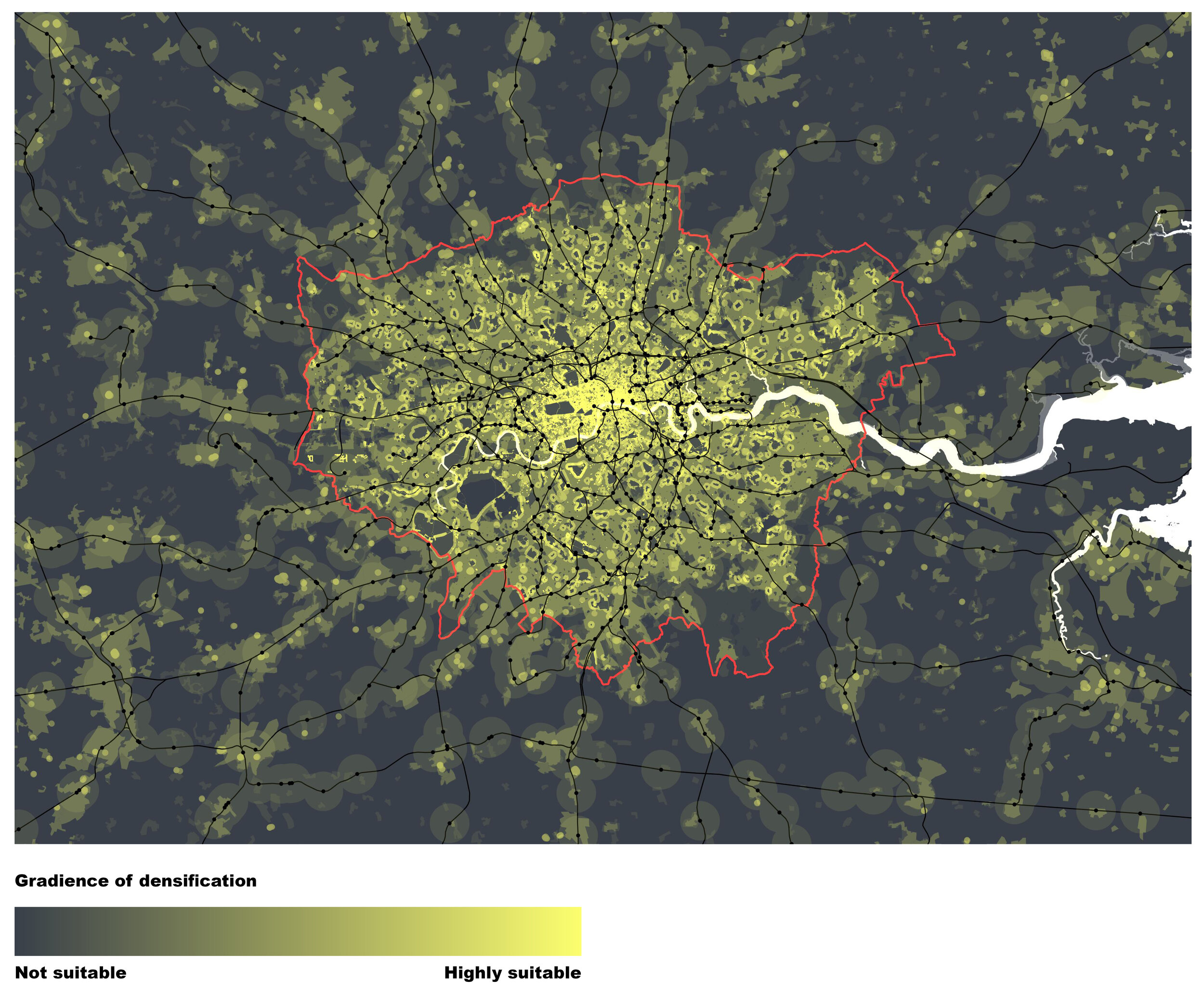
Through the development of an interactive GIS tool, we are exploring a system that will allow for the identification of areas that are suitable for densification. The underlying logic stems from the idea of a gradient system which assigns values in different areas based on the overlapping layers. This allows the user to define the suitability of each layer creating a flexible, non-rigid system.
In this first attempt, we explore the system as a visual tool that allows for the identification of spatial patterns.
Elements that are factored in include:
Average income
Number of residents per household/building
Type of housing (detached, semi-detached houses with gardens versus flats—linked to ‘quality of life’ during lockdown situations)
Proximity to healthcare provision (hospitals and community healthcare facilities)
Access to open spaces
No-car network (cycling paths, pedestrian zones, low-traffic neighbourhoods)
Rail network and proximity to rail stations
The Green Belt
Existing urbanised areas